Sonex 815 - Continuing the Kitlog - 9
*This web site is NOT owned or managed by Sonex, Ltd.. Sonex, Ltd. is not responsible for the content unless explicitly stated. See Disclaimer.
6/19/10 - Flight 139
0.4 flight time, 1 ldg. To KRYN for EAA meeting. On leaving KAVQ, it was all taildraggers in the pattern - that Stinson that I saw at one of the shows at CGZ, 2 Cessnas (taildraggers!), Brian's Citabria, and me. On calling KRYN tower, there was nobody else on the frequency. They told me what they wanted and I went right in. About 89 degrees OAT, starting to get bumpy.
6/19/10 - Flight 140
0.4 flight time, 1 ldg. Return from KRYN. 100 OAT at altitude (about 5000-5500 MSL), oil temp 210. Very bumpy in spots. Wind favoring 21, quite unusual. About 4 people entering the pattern around the same time, but it sorted out pretty well. One guy called downwind to 12, circled in front of me to DW on 21 (Extra 300). Drained the oil on return. Right about what I wanted - 25 hours on it.
6/20/10 - Flight 141
Finished up the oil change. Swapped out the filter. Removed the quick drain valve as it was leaking, but fortunately the stock Jabiru plug is the same thread, so I retained the 90 degree elbow feature (puts drain facing straight down). Quick flight out SW to check speed. Was indicating about 150 mph @ 2950 rpm. 138 ground speed out, 172 back, so there was some wind. Traffic (on the ground) after landing - I pulled out into the turn around, and 2 others passed by outbound. I had never seen them before, and they didn't call crossing 3-21, so I think they were visitors. 0.5 flight time, 1ldg.
6/22/10 - Flight 142
0.4 flight time, 5 ldg. Quick patterns early AM before it gets hot. Wind calm. Unpainted P-51 warming up 2 rows down from my hangar. C-172 making airliner patterns. I cut inside her twice - was making patterns more than twice as fast. 3 power off approaches.
6/25/10 - Flight 143
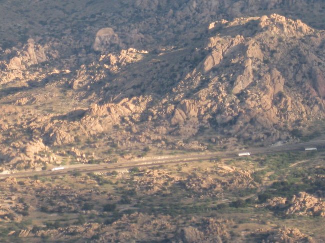
0.4 flight time, 1 ldg. Winds reported as 15 kts, straight down the runway. Made for a ridiculous angle of climb. Just before 7 am, temp already 88F. Flew over to the I-10 project, landed (really steep, short roll out), added 8 gallons fuel. Was indicating ~6.5 gallons on landing.
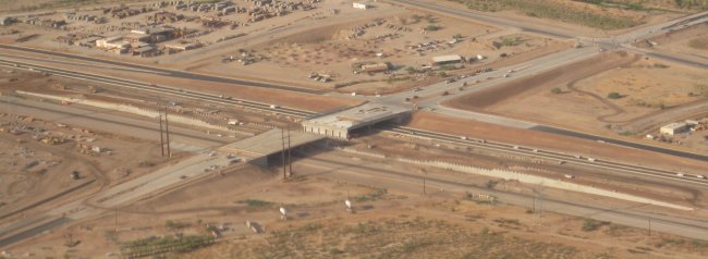
I-10 project, looking SW.
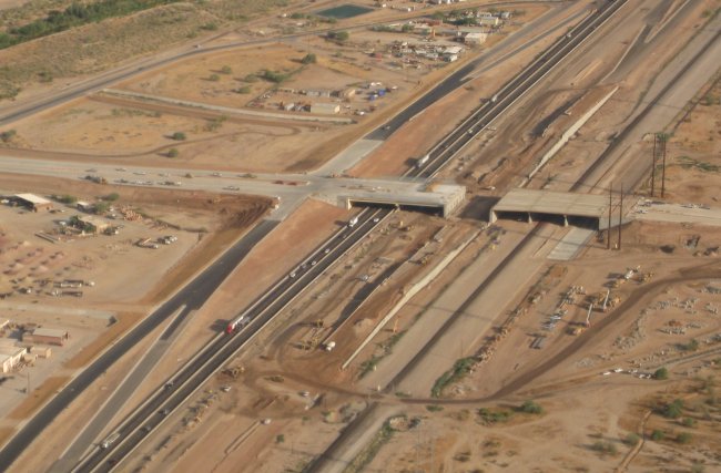
I-10 project, looking NW.
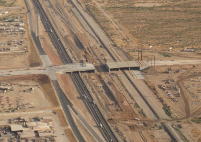
I-10 project, looking N.
6/26/10 - Flight 144
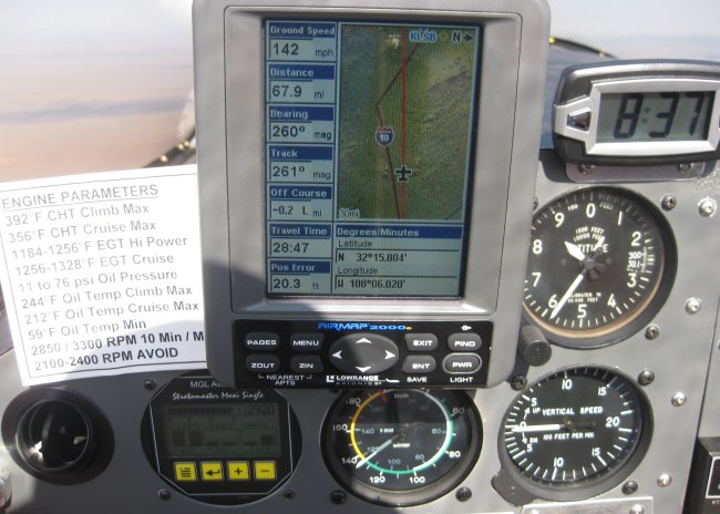
1.7 flight time, 1 ldg. From KAVQ to KDMN, 191 nm. Wheels up at 0629. Landed at 0757. First leg of the proposed Oshkosh trip. Went pretty well. Called TUS approach off of KAVQ, got a xpdr code. They handed me off to ABQ center around Benson. I didn't hear center at all. Turned the squelch back down and tried again. Yes, there they were - much quieter frequency out of the Tucson valley. There's a LOT of FM radio "resonances" or something that come through the radio in the valley. Held 7500' all the way over. The Aeroplanner flight plan was RIGHT ON. Legs to the minute. Pretty cool. Fuel burn estimate at 5gph was pretty close as well. Ran about 2950 rpm, and was seeing ground speeds on the order of 166 mph on the GPS. Deming is a long, long runway. A few planes in the area, but easy to get into. Fuel service was quick, friendly. At first he thought I was an Aerovee'd Sonex that had passed through a few weeks before.
Texas Canyon, East of Benson, West of Willcox.
Texas Canyon, closer view.
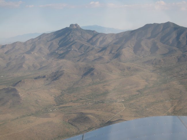
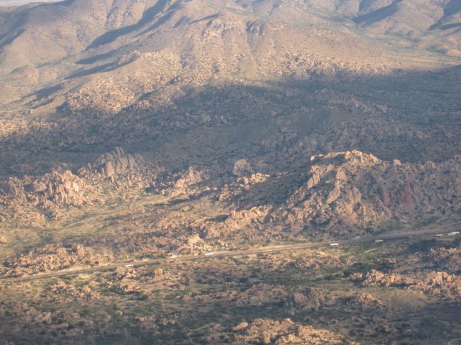
Dos Cabezas mountain, looking N.
6/26/10 - Flight 145
1.8 flight time, 1 ldg. DALT ~6500' - noticeably longer ground roll and flatter angle of climb. A pleasant 72F OAT at altitude. Used 8500' for return. Went a hair slower than the Aeroplanner plan, and cut off the last waypoint (TUS VOR) on return at the request of the controller. When I came around the ridge from Benson, he asked me to "resume own navigation direct Marana", so I cut the corner and went around the N side of Davis Monthan, and right over Don & Betty's house at First & River. It got HOT on descent (oat from 72 to 100F). Big wind at KAVQ - 15 kts at 150. I should have done a wheel landing - control was marginal in the "3 pointer" that I tried. Overall, not bad for the first long X-C, but that seat sure gets HARD.
Middle of the first leg. That's Lordsburg upper right.
Dos Cabezas mountain, looking NW.
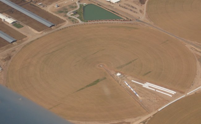
CIE VOR in the middle of a farm.
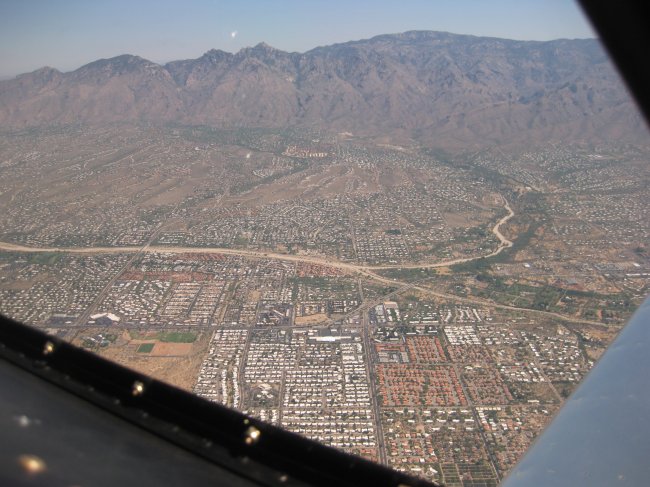
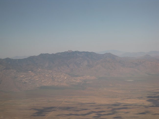
NE Tucson.
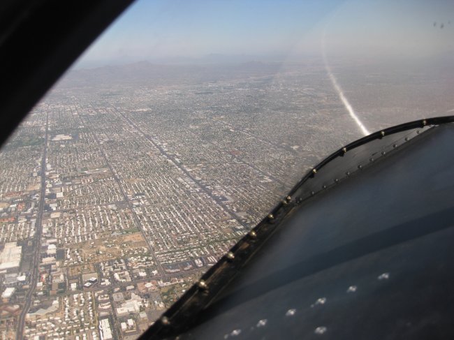
Central Tucson.